Hi everyone,
I would like to introduce my custom integration Cardata Analytics.
The project started from a simple idea: I wanted to do more with the vehicle data that already exists in Home Assistant instead of just displaying individual sensor values.
Cardata Analytics is now designed to be generic and is not tied to a specific vehicle manufacturer. As long as the relevant vehicle data is available as Home Assistant sensor entities, the integration can be used with different vehicles and data sources.
Current features
Cardata Analytics currently includes:
- support for multiple vehicles
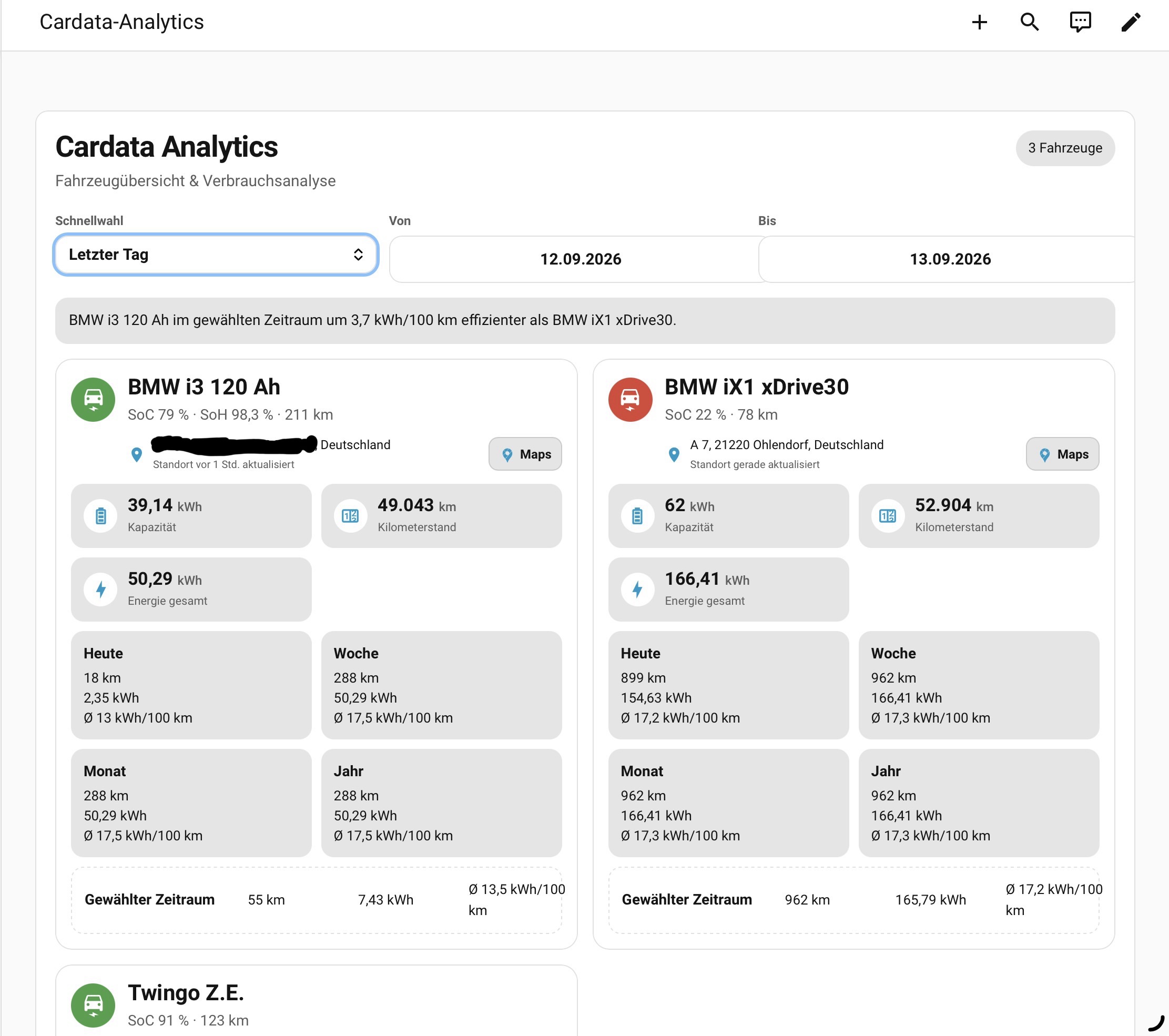
- SoC, SoH, remaining range, battery capacity and mileage
- driven distance and energy consumption
- average consumption in kWh/100 km
- analytics for today, week, month, year and custom date ranges
- persistent Daily Ledger for historical vehicle data
- vehicle comparison for selected time periods
- dedicated analytics dashboard card
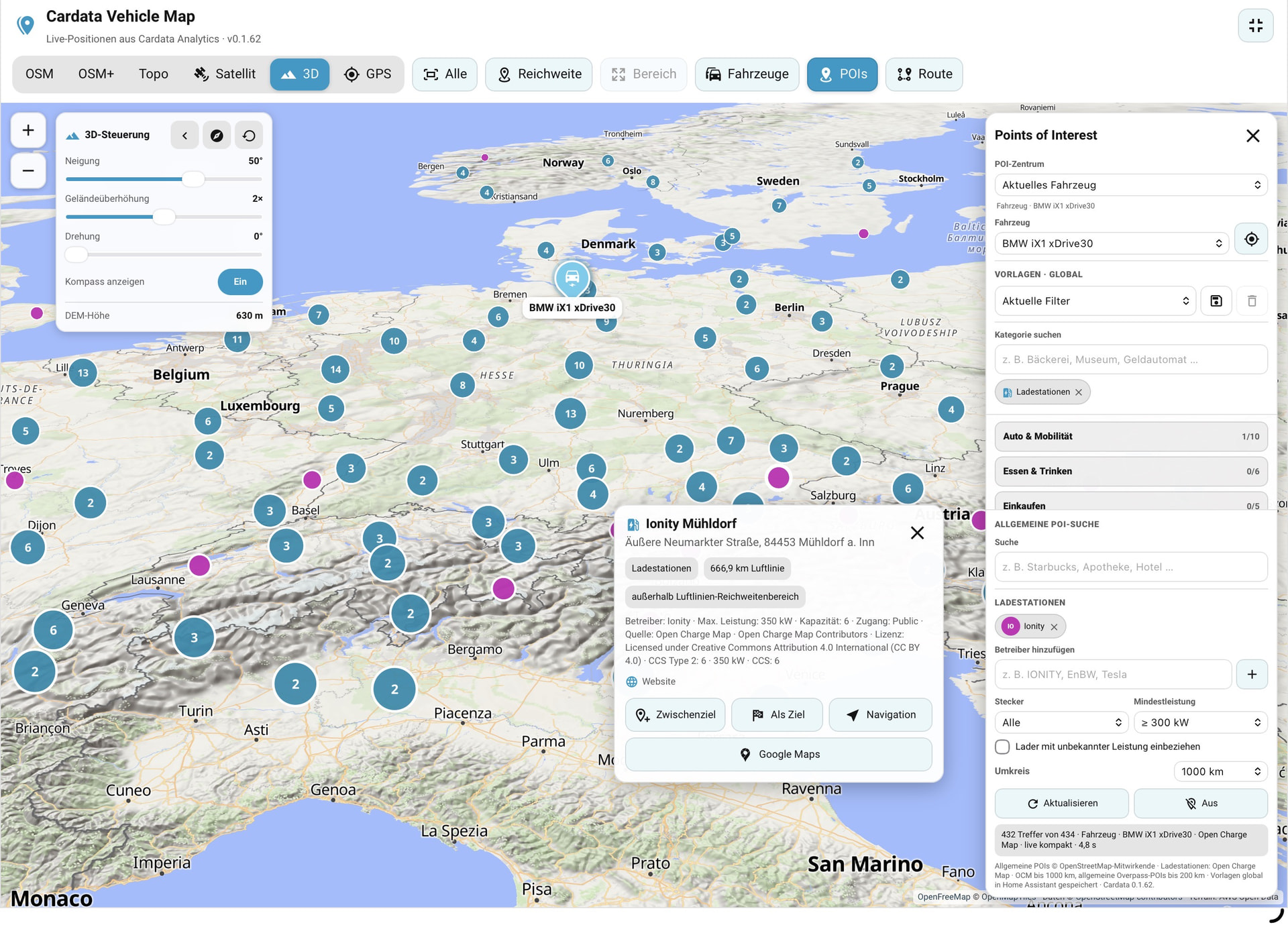
- dedicated MapLibre vehicle map
- OSM / OpenTopoMap / satellite view
- multiple vehicles with fixed colors and individual range rings
- GPS follow and movement information
- responsive layout for desktop, tablet and smartphone / iPhone
- German and English localization
POIs and charging stations
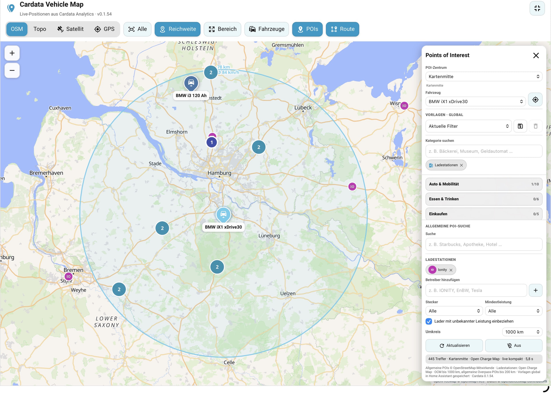
The map also includes a comprehensive POI system.
General POIs are retrieved from OpenStreetMap / Overpass, while EV charging stations are handled separately through Open Charge Map.
Open Charge Map is used because it provides structured charging infrastructure data such as:
- charging operator
- connector type
- charging power
- charging location details
A free Open Charge Map API key is required and can be configured directly in the integration.
Charging stations can be filtered by operator, connector type, minimum charging power and search radius. Multiple charging operators can be selected at the same time, and POI configurations can be stored as reusable global templates.
The map also supports POI clustering for larger result sets.
Map and route planning
The map is more than just a vehicle position display.
Vehicles can be followed live, remaining range can be visualized, and POIs can be searched around the vehicle, route destination or map center.
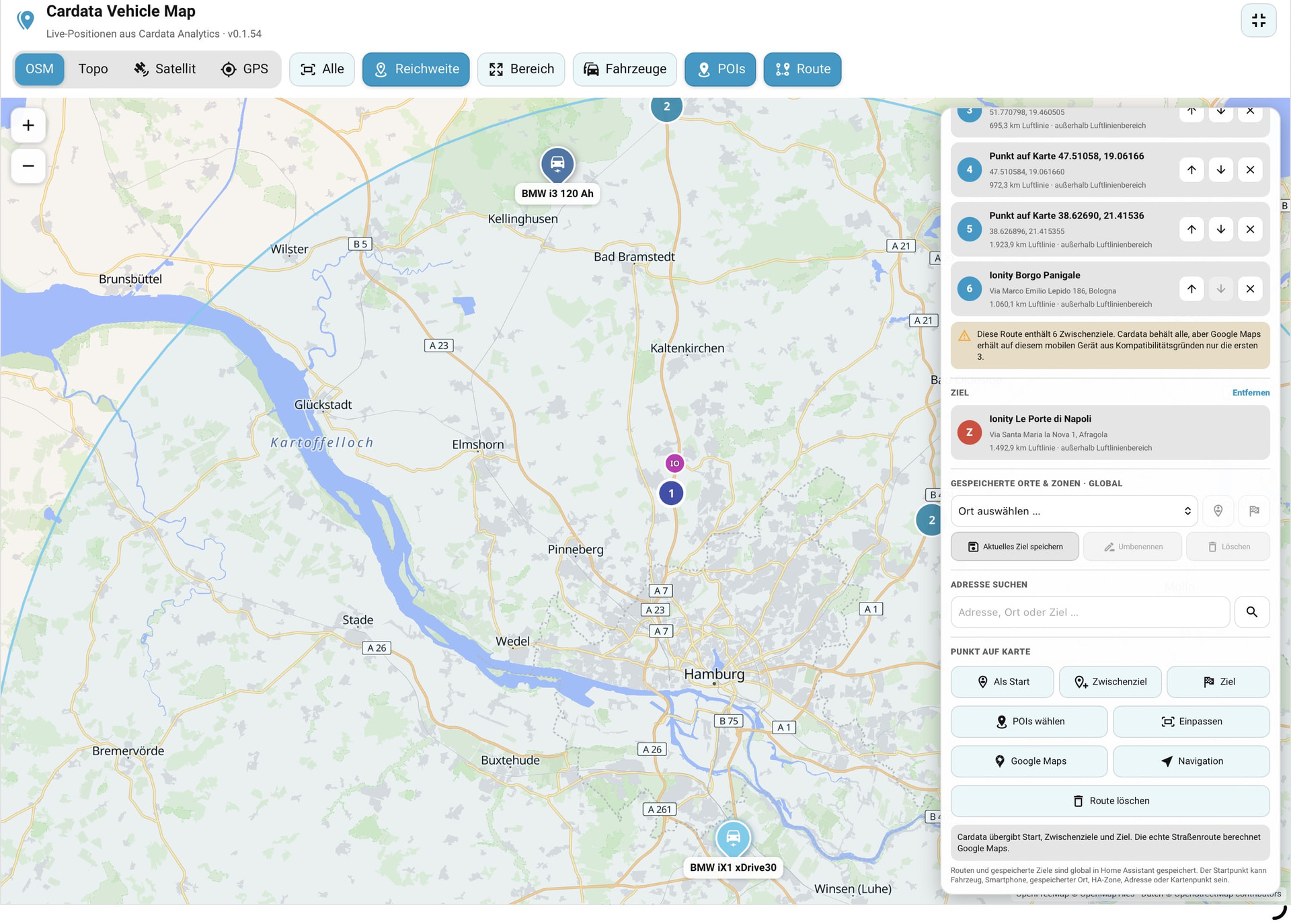
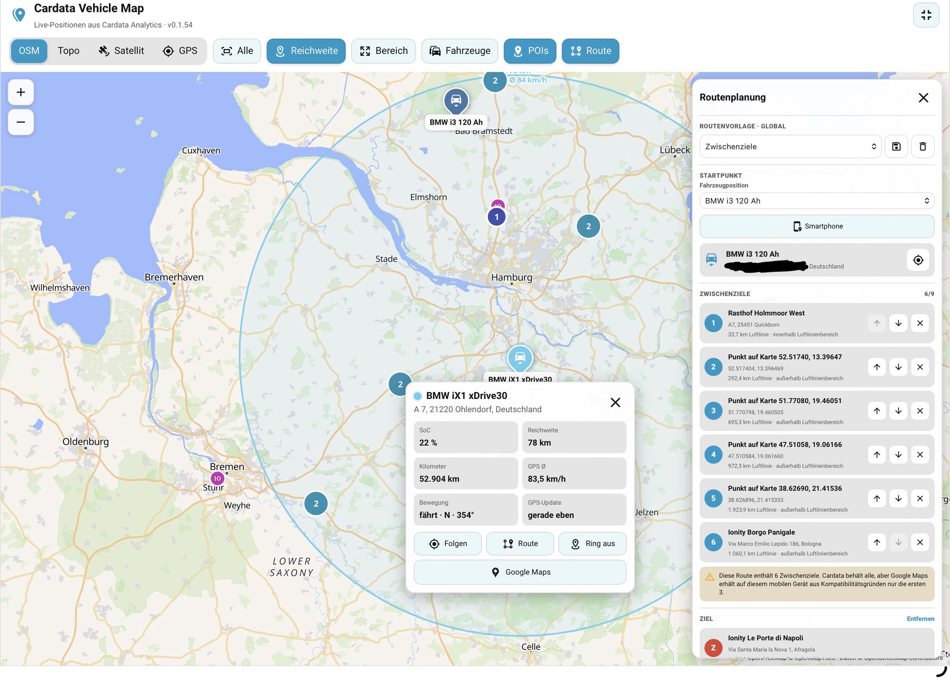
Route planning itself is done directly inside Cardata Analytics.
You can build a route using:
- vehicle position
- current smartphone location
- globally saved places
- Home Assistant zones
- address search results
- POIs
- freely selected map points
These can be used as the route start, waypoint or destination.
Cardata Analytics can manage up to 9 internal waypoints, and complete routes can be saved as reusable global route templates.
Once the route has been prepared, it can be handed over to Google Maps for the actual turn-by-turn navigation.
So in short:
Cardata Analytics handles the route planning and destination management, while Google Maps is used as the external navigation engine.
On mobile devices, up to 3 waypoints are handed over to Google Maps for compatibility, while Cardata Analytics keeps the full route with up to 9 waypoints internally.
This also means route planning is not limited to vehicles with GPS data. For example, a vehicle without its own GPS position can still be used together with a smartphone location, a saved address, a Home Assistant zone or a freely selected point on the map.
Saved destinations and templates
Cardata Analytics supports reusable global data such as:
- saved destinations
- Home / Work-style locations
- Home Assistant zones
- POI templates
- complete route templates
This makes frequently used trips or POI searches easy to reuse.
Installation
The project is intended to be used as a HACS custom integration.
GitHub repository:
The repository contains a detailed README with:
- installation instructions
- integration setup
- card configuration
- Open Charge Map setup
- screenshots
- full feature overview
Current status
The integration is still under active development. I am already using it successfully with several vehicles in daily use, but feedback is very welcome.
I would be especially interested in:
- testing with other vehicle manufacturers
- different vehicle data sources
- mobile / iPhone feedback
- feedback on POI and route planning
- ideas for additional useful vehicle analytics
Bug reports and feature requests are welcome here:
The project is released under the MIT License. Forks, modifications and further development are explicitly welcome.
I would be very happy to hear your feedback, test results and suggestions.